

Tenzin Nyidon
DHARAMSHALA, Aug. 11: India has renewed its demand for China to resume sharing hydrological data on the Brahmaputra and provide information on upstream river projects, as Beijing moves ahead with the construction of what is expected to be the world’s largest hydropower dam on the Yarlung Tsangpo in Tibet, the river that flows into India as the Brahmaputra.
The issue was raised during the 36th meeting of their ‘Working Mechanism for Consultation and Coordination (WMCC) on India-China Border Affairs, held in New Delhi on August 6, with New Delhi seeking greater transparency over developments on the upstream stretches of transboundary rivers. India has also called for an early meeting of the India-China Expert Level Mechanism on Trans-border Rivers to discuss the resumption of hydrological data sharing.
The renewed demand comes as China moves ahead with construction of a mega-dam in Medog County, Nyingchi, Tibet, which began in December 2025. The project is estimated to cost around 1.2 trillion yuan (approximately $178 billion), making it the world’s most expensive hydropower project, and is expected to take about a decade to complete.
The project, planned on the lower reaches of the Yarlung Tsangpo in Tibet, is located upstream of the river’s entry into India’s north-eastern state of Arunachal Pradesh, where it is known as the Siang before joining the Brahmaputra river system. Its sheer scale and strategic location have raised concerns in India over downstream water security, potential ecological impacts, and the availability of reliable information on upstream river flows.
Hydrological information is particularly important for India because upstream measurements of rainfall, water levels, and river discharge can help downstream authorities monitor and prepare for floods and other extreme events.
India and China have had arrangements for sharing hydrological information on the Brahmaputra during the flood season. Under the Memorandum of Understanding between the Ministry of Water Resources, signed on May 20, 2013, China has committed to providing India with information on water levels, discharge, and rainfall from three hydrological stations (Nugesha, Yangcun, and Nuxia) on the Yarlung Tsangpo. The arrangement was operationalised through an Implementation Plan signed in June 2014. The arrangements have, however, been disrupted in recent years.
Indian officials have said that China has not provided hydrological data on the Brahmaputra since June 2023, making the restoration of data sharing an increasingly important issue for New Delhi. The existing framework also provides for cooperation through an Expert Level Mechanism on transboundary rivers. India has sought an early meeting of the mechanism to revive discussions on hydrological information and broader river cooperation.
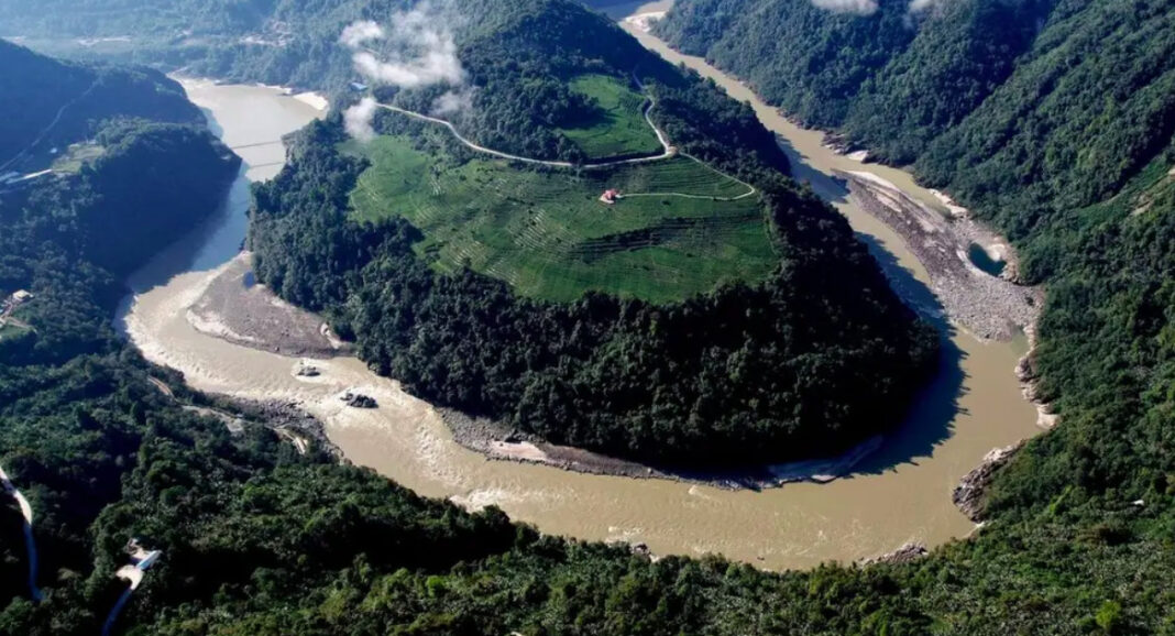
China’s decision to proceed with the Yarlung Tsangpo project has added a new dimension to the longstanding dispute over river data. The project is planned at a dramatic bend of the Yarlung Tsangpo in south-eastern Tibet, where the river descends sharply through the Himalayas. Its enormous hydropower potential has made the area a major focus of China’s energy and infrastructure ambitions.
For India, however, the project raises questions beyond electricity generation. The concern is whether large-scale infrastructure on the upper reaches of a transboundary river could affect downstream flows, sediment movement, ecosystems, or flood patterns. India has previously expressed concern to Beijing over the project, stressing the need for transparency and consultation regarding developments on transboundary rivers.
China has maintained that its hydropower development on the Yarlung Tsangpo is intended for clean energy generation and has sought to reassure downstream countries about the environmental and safety standards of its projects.
Indian media reports indicate that there is currently no established evidence to suggest that the project will divert the Brahmaputra’s waters away from India. The immediate issue for New Delhi is therefore not simply the quantity of water reaching India, but also access to reliable upstream information and greater transparency about China’s activities on the river in occupied Tibet.

